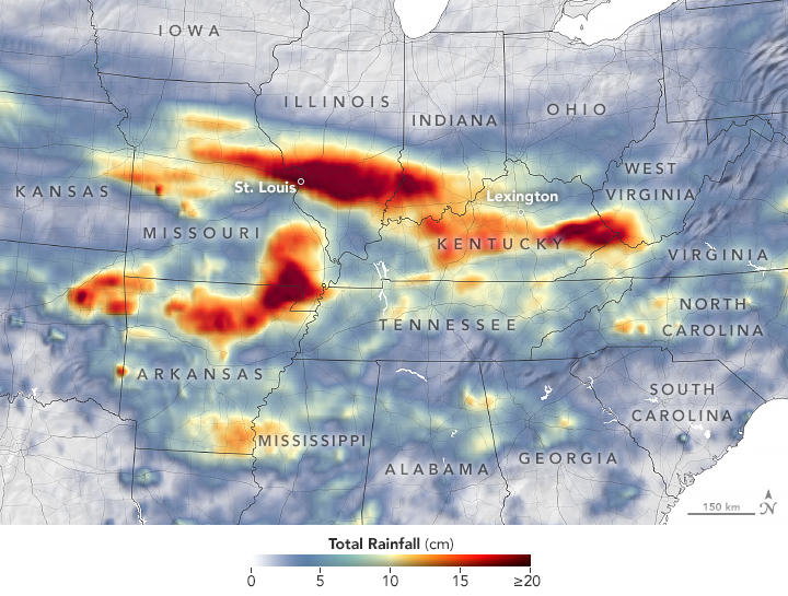

Record breaking rainfall bought devastating very big flash floods and landslides to many states such as Missouri and Kentucky and other parts of the central United States in the last week of July 2022. As noted previously, the Intergovernmental Panel on Climate Change and the American Meteorological Society say that these extreme precipitation events are occurring due to climate change!
The map which is given above shows the satellite-based estimate of rainfall from July 25 – 31 of 2022. The darkest reds reflect the highest rainfall amounts in the region. States including Missouri, Arkansas, Illinois, Indiana, and Kentucky received more than 8 inches of rain. Due to the averaging of the satellite data, local rainfall may be higher when measured from the ground.
These storms started on July 25-26 near St. Louis, Missouri when thunderstorms rolled through the region one after the other. The National Weather Service stated that rainfall rates were about 2 inches per hour. St Louis airport set a record of over 8.64 inches of rain! The previous record was set in 1915 when the remnants of a hurricane caused so much rain in the airport.
Let’s hope that we could stop climate change to stop these kinds of unexpected weather from occurring to make our beloved earth a better place to live!
Author: Sri Nihal Tammana
Source: NASA Earth Observatory
PC: NASA Earth Observatory


© copyright 2022 by Recycle My Battery