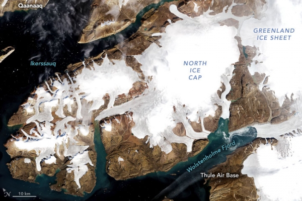

A couple of satellite pictures obtained very nearly 50 years separated uncovers striking changes to the ice sheets and ice covers in northwest Greenland.
Observations of the earth are now very common. But in the 1970s, there were no observatory earth satellites launched up into space. That all changed when the first ever earth observatory satellite was launched into space in 1972. This satellite was called Landsat 1. The Landsat mission is still continuing to this day with the launch of the latest Landsat satellite in 2021!
This picture pair traverses the Landsat time up until this point, uncovering changes across a landmass north of Thule Air Base (Pituffik). The Multispectral Scanner System (MSS) on Landsat 1 gained the primary picture (left) on September 3, 1973. The subsequent picture (right), gained on August 20, 2022, by the Operational Land Imager (OLI) on Landsat 8, shows a similar region 49 years after the fact.
We have to stop global warming o stop ice caps from melting to make our beloved earth a better place to live!
Author: Sri Nihal Tammana
Source: NASA Earth Observatory
PC: NASA Earth Observatory


© copyright 2022 by Recycle My Battery